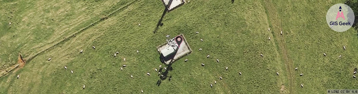
Location Overview
The OneNZ Ngongotaha location is 17m high, has 8 licences associated, and is capable* of 2G GSM, 3G UMTS, 4G LTE and 5G.
GIS Geek | LINZ | GMaps | Street View
Login required to upload photos or suggest corrections.
Closest Towers
| Provider | Location Name | Distance | Bearing |
|---|---|---|---|
| Spark | Ngongotaha Town | 50m | 45.2 |
| OneNZ | Kawaha Point | 3.22km | 134.85 |
| 2Degrees | Ngongotaha | 16m | 356.4 |
| RCG | RBPTPB - Te Pohue Bay | 10.74km | 81.6 |
Licence Details
Close Cell IDs OneNZ MMC: 530 MNC: 1
| Radio | Area | Cell | Distance from tower | Bearing from tower | Samples |
|---|---|---|---|---|---|
| LTE | 42592 | 270387 | 566m | 350.32 | 15 |
| GSM | 207 | 19193 | 578m | 31.91 | 1 |
| UMTS | 1706 | 6831 | 624m | 319.75 | 1 |
| LTE | 42592 | 716801 | 643m | 44.33 | 9 |
| LTE | 42592 | 270357 | 636m | 48.91 | 12 |
| GSM | 1706 | 46786 | 701m | 61.03 | 17 |
| GSM | 1706 | 39935 | 901m | 60.92 | 1 |
| UMTS | 1706 | 62363157 | 918m | 88.85 | 4 |
| LTE | 42592 | 716802 | 955m | 91.65 | 15 |
| UMTS | 1706 | 3170682 | 1.07km | 302.61 | 1 |
| LTE | 42592 | 1542660 | 1.04km | 96.16 | 3 |
| UMTS | 1706 | 62363164 | 1.13km | 85.23 | 11 |
| UMTS | 1706 | 62384074 | 1.16km | 104.43 | 4 |
| UMTS | 1706 | 62365131 | 1.21km | 105.36 | 3 |
| GSM | 135 | 9841 | 1.23km | 108.1 | 106 |
| GSM | 234 | 9841 | 1.38km | 115.51 | 21 |