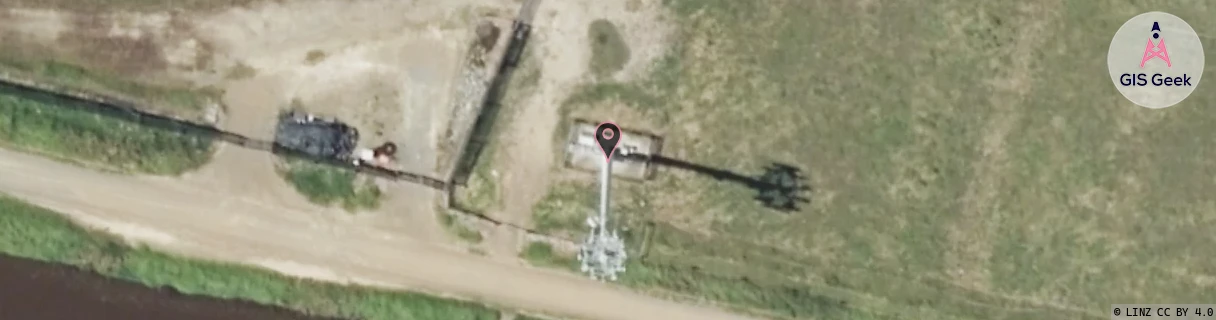
Location Overview
The Spark Whakatane West location is 30m high, has 6 licences associated, and is capable* of 3G UMTS and 4G LTE.
GIS Geek | LINZ | GMaps | Street View
Login required to upload photos or suggest corrections.
Closest Towers
| Provider | Location Name | Distance | Bearing |
|---|---|---|---|
| Spark | Awatapu Drive | 3.35km | 114.68 |
| OneNZ | Whakatane West | 0m | 0 |
| 2Degrees | Whakatane South | 3.49km | 125.52 |
| RCG | RBPTNT - Taneatua | 12.12km | 151.19 |
Licence Details
Close Cell IDs Spark MMC: 530 MNC: 5
| Radio | Area | Cell | Distance from tower | Bearing from tower | Samples |
|---|---|---|---|---|---|
| UMTS | 48391 | 3173744 | 764m | 348.62 | 8 |
| LTE | 48221 | 375687 | 1.05km | 315.05 | 21 |
| LTE | 0 | 3173741 | 1.11km | 57.64 | 3 |
| LTE | 0 | 3173744 | 1.49km | 8.78 | 1 |
| UMTS | 48311 | 3171840 | 1.38km | 56.99 | 21 |
| LTE | 48181 | 375673 | 1.66km | 212.23 | 5 |
| LTE | 48221 | 375667 | 1.47km | 80.23 | 8 |
| LTE | 48181 | 375663 | 1.6km | 78.64 | 4 |
| LTE | 48181 | 375683 | 1.97km | 324.11 | 62 |
| UMTS | 48391 | 3171840 | 1.74km | 69.9 | 16 |
| UMTS | 48391 | 3173742 | 1.76km | 86.56 | 20 |
| UMTS | 48398 | 3173854 | 1.77km | 91.37 | 5 |