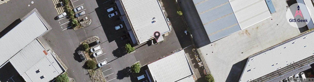
Location Overview
The Spark Browns Road location is 11m high, has 7 licences associated, and is capable* of 3G UMTS, 4G LTE and 5G.
GIS Geek | LINZ | GMaps | Street View
Login required to upload photos or suggest corrections.
Closest Towers
| Provider | Location Name | Distance | Bearing |
|---|---|---|---|
| Spark | Rowandale Ave | 1.16km | 121.23 |
| OneNZ | Manurewa West (VF A8MAW) | 109m | 19.2 |
| 2Degrees | Homai West | 305m | 342.41 |
| RCG | RAKMNB - Manawa Bay | 5.79km | 293.29 |
Licence Details
Close Cell IDs Spark MMC: 530 MNC: 5
| Radio | Area | Cell | Distance from tower | Bearing from tower | Samples |
|---|---|---|---|---|---|
| LTE | 18131 | 158242674 | 263m | 135.65 | 48 |
| UMTS | 13305 | 884500 | 313m | 169.13 | 1 |
| UMTS | 13305 | 884052 | 304m | 128.57 | 24 |
| LTE | 18131 | 501875 | 304m | 125.38 | 37 |
| UMTS | 13305 | 884053 | 358m | 234.99 | 35 |
| UMTS | 18398 | 884499 | 405m | 149.95 | 13 |
| UMTS | 13305 | 885003 | 422m | 211.41 | 11 |
| LTE | 18131 | 158242684 | 446m | 210.66 | 36 |
| LTE | 18131 | 501885 | 477m | 211.17 | 61 |
| UMTS | 13305 | 884049 | 416m | 93.93 | 5 |
| LTE | 18131 | 669565 | 506m | 28.2 | 52 |
| UMTS | 18398 | 884049 | 489m | 93.21 | 12 |
| UMTS | 18398 | 884051 | 570m | 322.81 | 10 |
| LTE | 18131 | 318073 | 495m | 82.07 | 3 |