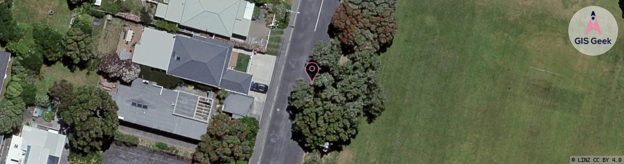
Location Overview
The 2Degrees Seatoun location is 15m high, has 7 licences associated, and is capable* of 3G UMTS, 4G LTE and 5G.
Location Raw Name: (WLG-047-031-J)[STUN]_SEATOUN
GIS Geek | LINZ | GMaps | Street View
Login required to upload photos or suggest corrections.
Closest Towers
| Provider | Location Name | Distance | Bearing |
|---|---|---|---|
| Spark | Seatoun | 81m | 191.64 |
| OneNZ | Seatoun South ONZ W6STS | 430m | 192.67 |
| 2Degrees | Wellington Airport | 1.79km | 250.37 |
| RCG | RWLBHE - Baring Head / Catchpool | 7.52km | 122.47 |
Licence Details
Close Cell IDs 2Degrees MMC: 530 MNC: 24
| Radio | Area | Cell | Distance from tower | Bearing from tower | Samples |
|---|---|---|---|---|---|
| UMTS | 20002 | 172175 | 451m | 194.14 | 3 |
| UMTS | 20001 | 171450 | 423m | 300.11 | 7 |
| UMTS | 20001 | 152180 | 555m | 185.16 | 1 |
| UMTS | 20001 | 172173 | 559m | 169.52 | 1 |
| UMTS | 20002 | 151680 | 501m | 274.85 | 1 |
| UMTS | 20002 | 172173 | 1.16km | 61.6 | 7 |
| UMTS | 20002 | 171353 | 1.4km | 28.77 | 2 |
| LTE | 62002 | 1605122 | 1.15km | 270.2 | 3 |
| UMTS | 20002 | 151450 | 1.51km | 335.2 | 1 |
| UMTS | 20002 | 151079 | 1.19km | 266.49 | 2 |
| LTE | 62002 | 1724930 | 1.47km | 322.9 | 1 |
| GSM | 8 | 20531 | 1.6km | 325.96 | 1 |
| LTE | 62002 | 1724932 | 1.56km | 313.97 | 3 |
| UMTS | 20002 | 1605122 | 1.47km | 241.39 | 1 |