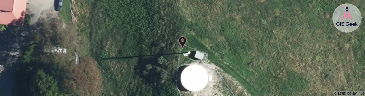
Location Overview
The Spark Riverdale location is 19m high, has 7 licences associated, and is capable* of 3G UMTS, 4G LTE and 5G.
GIS Geek | LINZ | GMaps | Street View
Login required to upload photos or suggest corrections.
Closest Towers
| Provider | Location Name | Distance | Bearing |
|---|---|---|---|
| Spark | Te Hapara | 860m | 179.22 |
| OneNZ | Lytton West | 478m | 231.54 |
| 2Degrees | Riverdale | 469m | 234.45 |
| RCG | RGBTBC - Tatapouri Beach Camp | 11.99km | 94.81 |
Licence Details
Close Cell IDs Spark MMC: 530 MNC: 5
| Radio | Area | Cell | Distance from tower | Bearing from tower | Samples |
|---|---|---|---|---|---|
| UMTS | 41101 | 2721248 | 556m | 101.77 | 1 |
| LTE | 4402 | 13105184 | 1.06km | 175.93 | 1 |
| UMTS | 41101 | 2721252 | 883m | 247.19 | 5 |
| UMTS | 48391 | 2917840 | 1km | 111.4 | 1 |
| LTE | 48181 | 13105184 | 1.48km | 170.37 | 10 |
| LTE | 4402 | 13338913 | 1.79km | 206.72 | 1 |
| LTE | 48181 | 13338913 | 1.84km | 196.63 | 5 |
| LTE | 4402 | 13338911 | 1.82km | 139.48 | 1 |
| UMTS | 44101 | 2921763 | 1.95km | 217.88 | 1 |
| UMTS | 48391 | 2917859 | 1.97km | 218.68 | 4 |
| LTE | 4402 | 13338912 | 2.13km | 173.88 | 1 |
| UMTS | 48391 | 2917856 | 2.02km | 221 | 1 |
| UMTS | 48391 | 2917775 | 2.02km | 221 | 3 |
| UMTS | 48391 | 2921760 | 2.02km | 221 | 1 |