Location Overview
The 2Degrees Taupo Airport location is 23m high, has 5 licences associated, and is capable* of 3G UMTS and 4G LTE.
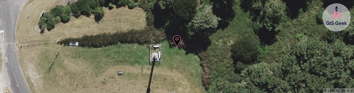
Location has been manually adjusted based on user feedback.
Location Raw Name: (WKT-021-012-A)[TAUA]_TAUPO AIRPORT
GIS Geek | LINZ | GMaps | Street View
Login required to upload photos or suggest corrections.
Closest Towers
| Provider | Location Name | Distance | Bearing |
|---|---|---|---|
| Spark | Taupo Airport | 10m | 65.75 |
| OneNZ | Taupo Airport VF C4TOA | 293m | 300.4 |
| 2Degrees | Rainbow Point Aau | 2.1km | 5.24 |
| RCG | RWKWTN - Waitahanui | 5.99km | 178.02 |
Licence Details
Close Cell IDs 2Degrees MMC: 530 MNC: 24
| Radio | Area | Cell | Distance from tower | Bearing from tower | Samples |
|---|---|---|---|---|---|
| UMTS | 22208 | 281101 | 315m | 71.61 | 3 |
| UMTS | 22208 | 270087 | 430m | 25.57 | 2 |
| UMTS | 22208 | 271099 | 548m | 324.55 | 2 |
| LTE | 62208 | 2842630 | 616m | 2.9 | 20 |
| LTE | 62208 | 1760779 | 983m | 124.61 | 21 |
| LTE | 62208 | 2842649 | 1.18km | 35.85 | 6 |
| GSM | 135 | 9652 | 1.65km | 128.01 | 13 |
| UMTS | 22208 | 271095 | 1.74km | 43.79 | 2 |
| GSM | 208 | 18951 | 1.99km | 167.87 | 2 |
| LTE | 62208 | 1761291 | 1.73km | 57.11 | 15 |