Location Overview
The 2Degrees Peninsula Hill location is 14m high, has 5 licences associated, and is capable* of 3G UMTS, 4G LTE and 5G.
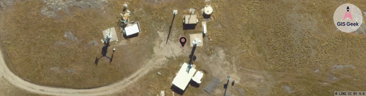
Location Raw Name: (OTG-070-001-A)[PENH]_PENINSULA HILL
GIS Geek | LINZ | GMaps | Street View
Login required to upload photos or suggest corrections.
Closest Towers
| Provider | Location Name | Distance | Bearing |
|---|---|---|---|
| Spark | Peninsula Hill | 14m | 195.09 |
| OneNZ | Queenstown/Frankton (VF S5FKT) | 50m | 305.7 |
| 2Degrees | Peninsula_Hill | 0m | 0 |
| RCG | ROTWQT - West Queenstown | 19.64km | 242.93 |
Licence Details
Close Cell IDs 2Degrees MMC: 530 MNC: 24
| Radio | Area | Cell | Distance from tower | Bearing from tower | Samples |
|---|---|---|---|---|---|
| LTE | 62219 | 1770507 | 1.49km | 42.46 | 13 |
| LTE | 62219 | 2870295 | 1.76km | 330.96 | 8 |
| UMTS | 22219 | 424165 | 1.99km | 18.13 | 7 |
| UMTS | 22219 | 444165 | 1.98km | 25.68 | 7 |
| LTE | 62219 | 1692520 | 1.59km | 74.29 | 50 |
| LTE | 62219 | 1692518 | 1.97km | 37.65 | 4 |
| LTE | 62219 | 2803202 | 2.21km | 356.56 | 50 |
| UMTS | 22219 | 444161 | 2.21km | 6.99 | 3 |
| UMTS | 22219 | 817239 | 2.32km | 25.69 | 18 |
| UMTS | 22219 | 444159 | 1.93km | 62.34 | 9 |