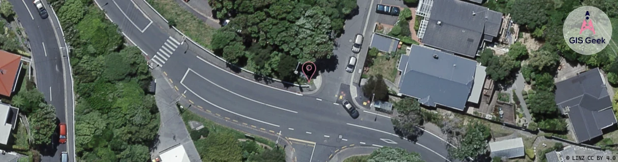
Location Overview
The 2Degrees Wadestown East location is 11m high, has 6 licences associated, and is capable* of 3G UMTS, 4G LTE and 5G.
Location Raw Name: (WLG-047-027-C)[WADE]_WADESTOWN EAST
GIS Geek | LINZ | GMaps | Street View
Login required to upload photos or suggest corrections.
Closest Towers
| Provider | Location Name | Distance | Bearing |
|---|---|---|---|
| Spark | Wadestown Road | 109m | 301.06 |
| OneNZ | Lennel Road ONZ W6LNL | 209m | 143.17 |
| 2Degrees | Wadestown Vill | 220m | 292.38 |
| RCG | RWLMAB - Makara Beach | 5.96km | 307.66 |
Licence Details
Close Cell IDs 2Degrees MMC: 530 MNC: 24
| Radio | Area | Cell | Distance from tower | Bearing from tower | Samples |
|---|---|---|---|---|---|
| UMTS | 20002 | 151920 | 27m | 253.23 | 5 |
| UMTS | 20002 | 171917 | 27m | 253.23 | 5 |
| UMTS | 20002 | 151921 | 136m | 347.94 | 6 |
| UMTS | 20002 | 171915 | 164m | 191.37 | 3 |
| UMTS | 20002 | 151919 | 230m | 52.37 | 22 |
| UMTS | 20002 | 172164 | 328m | 159.16 | 1 |
| UMTS | 20002 | 171395 | 255m | 272.63 | 6 |
| UMTS | 20002 | 152069 | 359m | 5.88 | 24 |
| LTE | 62002 | 2661121 | 403m | 339.89 | 3 |
| LTE | 62002 | 2665217 | 417m | 324.18 | 3 |
| UMTS | 20002 | 151399 | 465m | 345.75 | 20 |
| LTE | 62002 | 2665241 | 439m | 321.74 | 2 |