Location Overview
The 2Degrees Orere Point location is 27m high, has 5 licences associated, and is capable* of 3G UMTS and 4G LTE.
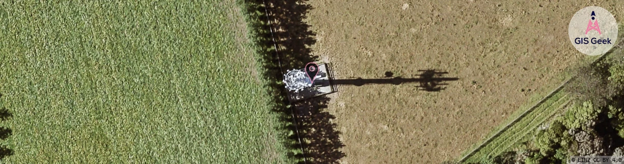
Location Raw Name: (AKL-008-101-B)[ORRP]_ORERE POINT
GIS Geek | LINZ | GMaps | Street View
Login required to upload photos or suggest corrections.
Closest Towers
| Provider | Location Name | Distance | Bearing |
|---|---|---|---|
| Spark | Orere Point | 40m | 156.47 |
| OneNZ | Orere Point | 13m | 340.08 |
| 2Degrees | S_Kawakawa Bay | 6.72km | 292.75 |
| RCG | RAKNEV - Ness Valley | 12.25km | 251.17 |
Licence Details
Close Cell IDs 2Degrees MMC: 530 MNC: 24
| Radio | Area | Cell | Distance from tower | Bearing from tower | Samples |
|---|---|---|---|---|---|
| LTE | 62207 | 1812483 | 3.13km | 235.72 | 2 |
| UMTS | 22207 | 62384343 | 3.8km | 152.4 | 1 |
| UMTS | 22204 | 280033 | 4.27km | 138.95 | 1 |
| UMTS | 22204 | 591567 | 9.74km | 279.48 | 1 |
| UMTS | 22204 | 270609 | 9.86km | 279.36 | 1 |
| UMTS | 10007 | 62384923 | 13.85km | 273.05 | 1 |
| GSM | 135 | 35251 | 17km | 162.16 | 4 |
| UMTS | 10007 | 601571 | 13.89km | 272.49 | 3 |
| GSM | 3 | 11743 | 14.87km | 295.62 | 3 |
| GSM | 3 | 11741 | 15.89km | 305.71 | 4 |