Location Overview
The 2Degrees Kaitoke location is 14m high, has 5 licences associated, and is capable* of 3G UMTS and 4G LTE.
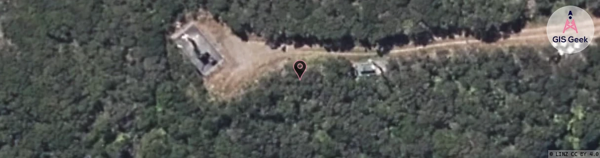
Location Raw Name: (WLG-045-015-A)[KTKE]_KAITOKE
GIS Geek | LINZ | GMaps | Street View
Login required to upload photos or suggest corrections.
Closest Towers
| Provider | Location Name | Distance | Bearing |
|---|---|---|---|
| Spark | Kaitoke | 113m | 92.61 |
| OneNZ | Kaitoke | 64m | 227.38 |
| 2Degrees | Te Marua | 8.72km | 247.03 |
| RCG | RWLMAY - Maymorn | 7.91km | 225.98 |
Licence Details
Close Cell IDs 2Degrees MMC: 530 MNC: 24
| Radio | Area | Cell | Distance from tower | Bearing from tower | Samples |
|---|---|---|---|---|---|
| UMTS | 22217 | 368723 | 3.09km | 232.88 | 241 |
| LTE | 62217 | 1807107 | 3.31km | 218.94 | 153 |
| UMTS | 20001 | 172115 | 3.44km | 216.1 | 1 |
| UMTS | 20001 | 152119 | 3.93km | 183.08 | 1 |
| UMTS | 20001 | 152120 | 3.71km | 213.51 | 1 |
| UMTS | 20001 | 172113 | 4.23km | 178.73 | 1 |
| UMTS | 20001 | 21041 | 4.54km | 176.89 | 1 |
| UMTS | 22217 | 348727 | 4.57km | 171.02 | 27 |
| UMTS | 7 | 368721 | 4.7km | 175.13 | 1 |
| UMTS | 7 | 348727 | 4.86km | 173.5 | 1 |