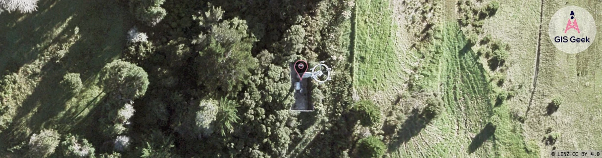
Location Overview
The 2Degrees Upper Orewa location is 17m high, has 6 licences associated, and is capable* of 3G UMTS, 4G LTE and 5G.
Location Raw Name: (AKL-004-054-B)[UORW]_UPPER OREWA
GIS Geek | LINZ | GMaps | Street View
Login required to upload photos or suggest corrections.
Closest Towers
| Provider | Location Name | Distance | Bearing |
|---|---|---|---|
| Spark | Upper Orewa | 51m | 105.91 |
| OneNZ | Upper Orewa | 18m | 95.24 |
| 2Degrees | Orewa West | 2.4km | 39.27 |
| RCG | RAKWRN - Weranui | 3km | 304.34 |
Licence Details
Close Cell IDs 2Degrees MMC: 530 MNC: 24
| Radio | Area | Cell | Distance from tower | Bearing from tower | Samples |
|---|---|---|---|---|---|
| UMTS | 10001 | 729727 | 183m | 142.4 | 3 |
| UMTS | 10001 | 59098141 | 490m | 17.9 | 1 |
| UMTS | 10001 | 728621 | 513m | 65.18 | 3 |
| LTE | 61001 | 2767368 | 630m | 130.04 | 2 |
| LTE | 61001 | 2769927 | 630m | 130.04 | 2 |
| GSM | 202 | 18835 | 899m | 175.09 | 2 |
| LTE | 61001 | 1732099 | 963m | 179.47 | 126 |
| UMTS | 10001 | 59098142 | 1.05km | 179.95 | 1 |
| LTE | 61001 | 3010056 | 1.02km | 36.64 | 1 |
| LTE | 61001 | 1732097 | 1.09km | 20.29 | 50 |
| GSM | 202 | 18833 | 1.22km | 169.19 | 2 |
| GSM | 202 | 18831 | 1.21km | 36.1 | 4 |