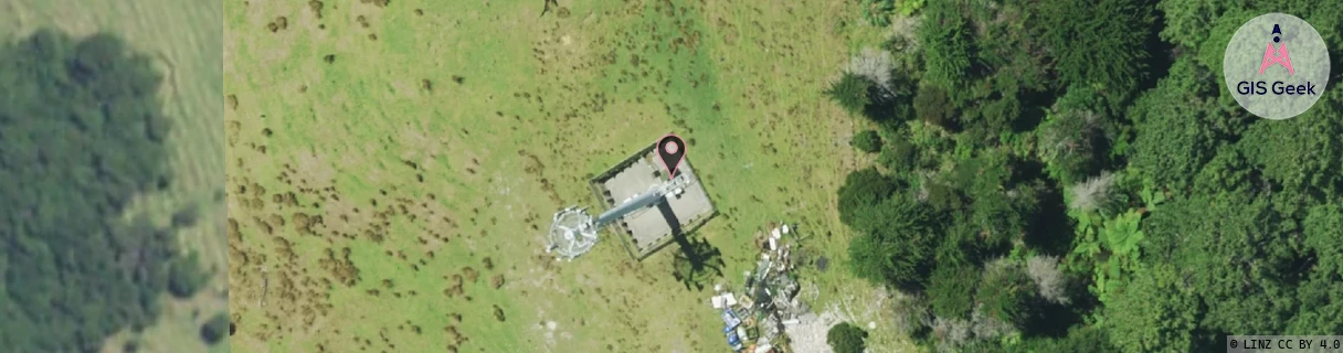
Location Overview
The 2Degrees Preece Point location is 25m high, has 4 licences associated, and is capable* of 3G UMTS and 4G LTE.
Location Raw Name: (WKT-011-016-A)[PRPT]_PREECE POINT
GIS Geek | LINZ | GMaps | Street View
Login required to upload photos or suggest corrections.
Closest Towers
| Provider | Location Name | Distance | Bearing |
|---|---|---|---|
| Spark | Preeces Point | 93m | 180.23 |
| OneNZ | Preece Point | 3m | 223.34 |
| 2Degrees | Preece Point Rbi | 0m | 0 |
| RCG | RWKKNB - Kennedy Bay | 10.72km | 24.92 |
Licence Details
Close Cell IDs 2Degrees MMC: 530 MNC: 24
| Radio | Area | Cell | Distance from tower | Bearing from tower | Samples |
|---|---|---|---|---|---|
| UMTS | 22204 | 270363 | 1.5km | 31.72 | 3 |
| GSM | 36 | 9411 | 1.62km | 5.49 | 23 |
| GSM | 204 | 18461 | 1.8km | 5.34 | 1 |
| UMTS | 22204 | 270611 | 1.81km | 352.45 | 3 |
| UMTS | 22204 | 280605 | 1.87km | 0.48 | 2 |
| GSM | 36 | 9412 | 1.6km | 116.76 | 14 |
| UMTS | 22204 | 270612 | 1.66km | 119.2 | 1 |
| LTE | 62204 | 1714694 | 1.99km | 349.81 | 7 |