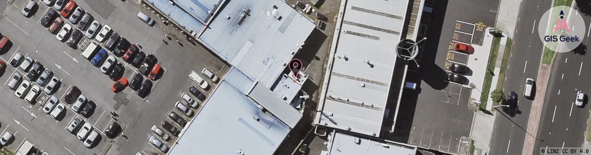
Location Overview
The Spark Chapel Road location is 14m high, has 7 licences associated, and is capable* of 3G UMTS, 4G LTE and 5G.
GIS Geek | LINZ | GMaps | Street View
Login required to upload photos or suggest corrections.
Closest Towers
| Provider | Location Name | Distance | Bearing |
|---|---|---|---|
| Spark | Aspiring Ave | 957m | 126.66 |
| OneNZ | Manukau East 2 VF A8MUE | 78m | 322.62 |
| 2Degrees | Manukau East | 71m | 178.74 |
| RCG | RAKBRB - Brookby | 7.35km | 96.86 |
Licence Details
Close Cell IDs Spark MMC: 530 MNC: 5
| Radio | Area | Cell | Distance from tower | Bearing from tower | Samples |
|---|---|---|---|---|---|
| UMTS | 13305 | 884093 | 68m | 18.42 | 1 |
| UMTS | 18398 | 884090 | 283m | 127.99 | 3 |
| LTE | 18131 | 535175 | 280m | 288.88 | 13 |
| UMTS | 18398 | 884293 | 348m | 343.63 | 2 |
| UMTS | 18398 | 1201773 | 365m | 145.54 | 20 |
| UMTS | 18398 | 884405 | 352m | 125.26 | 3 |
| UMTS | 13305 | 884090 | 416m | 155.98 | 1 |
| UMTS | 18398 | 1201776 | 494m | 155.71 | 18 |
| UMTS | 18398 | 1201770 | 497m | 134.95 | 29 |
| LTE | 18131 | 158241916 | 582m | 144.76 | 127 |
| UMTS | 18398 | 884093 | 579m | 42.37 | 4 |
| LTE | 18131 | 535165 | 638m | 162.87 | 106 |
| LTE | 18131 | 478585 | 664m | 185.19 | 2 |
| LTE | 18131 | 636549 | 554m | 107.05 | 51 |