Licence Overview
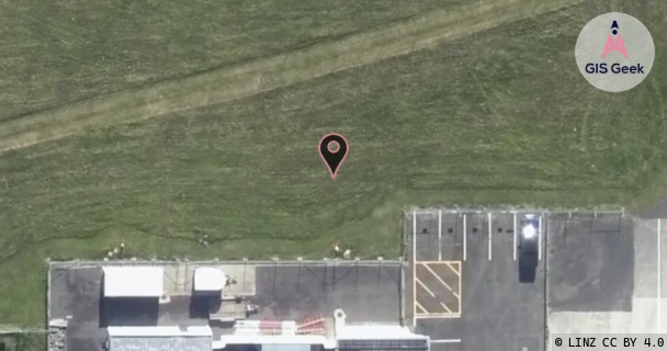
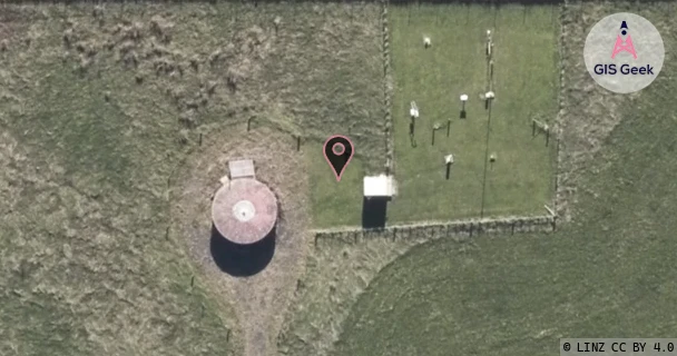
The link registered to Meteorological Service Of New Zealand Limited is a UHF band link at 443.78MHz. It transmits from Palmerston North Airport, and is received at Palmerston North Airport Weather Station , a distance of 498m.
TX: GIS Geek | LINZ | GMaps | Street View
RX: GIS Geek | LINZ | GMaps | Street View
Login required to upload photos or suggest corrections.
TX Location Client Stats
| Client | Links |
|---|---|
| Airways Corporation Of New Zealand Limited | 2 |
| Kordia Limited | 2 |
Licence and Location Details
| TX: Palmerston North Airport | |
|---|---|
| Antenna | RFI - RDA6 |
| Antenna Type | 6 ELEMENT YAGI |
| Equipment | 4Rf - APRISA SR+ 400 50K |
| RX: Palmerston North Airport Weather Station | |
|---|---|
| Antenna | RFI - RDA6 |
| Antenna Type | 6 ELEMENT YAGI |
| Equipment | 4Rf - APRISA SR+ 400 50K |
Associated Licence
| #1: Palmerston North Airport Weather Station | |
|---|---|
| Frequency | 448.78MHz |
| Frequency Range | 448.756MHz - 448.806MHz |
| Channel Width | 50kHz |
| Channel Code | JL16C# |
| Power dBW(eirp) | 0 |
| Emission | 50K0D7WEN |
| Licence Type | Fixed <1 GHz; BW <=50 kHz (Bi-directional) |
| Commenced | - |
| Licence Last Updated | - |
| RSM Licence ID | 404480 |
| RSM Licence # | 402245 |
Additional Links From TX Location
| Client | TX Location | Band | Frequency | RX Location |
|---|---|---|---|---|
| Airways Corporation Of New Zealand Limited | Palmerston North Airport | UHF | 443.18MHz | Palmerston North Airport(Dme) |
| Airways Corporation Of New Zealand Limited | Palmerston North Airport(Dme) | UHF | 448.18MHz | Palmerston North Airport |
| Kordia Limited | Palmerston North Airport | C | 7.603GHz | Wharite |
| Kordia Limited | Wharite | C | 7.442GHz | Palmerston North Airport |