Licence Overview
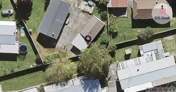
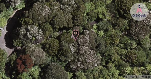
The link registered to Te Whanau O Waipareira Trust Inc. / Manukau Urban Maori Authority is a UHF band link at 932.88MHz. It transmits from 31 Calthorp Close Mangere, and is received at 39 Quinns Road, a distance of 20.2km.
TX: GIS Geek | LINZ | GMaps | Street View
RX: GIS Geek | LINZ | GMaps | Street View
Login required to upload photos or suggest corrections.
Licence and Location Details
| TX: 31 Calthorp Close Mangere | |
|---|---|
| Antenna | RFI - YB915 |
| Antenna Type | 15 ELEMENT K BAND YAGI |
| Equipment | Rvr - PTRLNV/HP |
| RX: 39 Quinns Road | |
|---|---|
| Antenna | SCALA - PR-900 |
| Antenna Type | PARAFLECTOR K BAND |
| Equipment | Rvr - RXRLNV |
Additional Links From RX Location
| Client | TX Location | Band | Frequency | RX Location |
|---|---|---|---|---|
| Auckland Council | 39 Quinns Road | UHF | 459.14MHz | Multiple: Manakau Heads, Muriwai, Te Ahua, Auckland Council Reserve Long Road Waitakere |
| Auckland Council | Auckland Council Reserve Long Road Waitakere | UHF | 454.1MHz | 39 Quinns Road |
| Auckland Council | Manakau Heads | UHF | 454.1MHz | 39 Quinns Road |
| Auckland Council | Muriwai | UHF | 454.1MHz | 39 Quinns Road |
| Auckland Council | Te Ahua | UHF | 454.1MHz | 39 Quinns Road |
| Radio Samoa Network Nz Limited | 39 Quinns Road | UHF | 413.48MHz | Henderson |
| Radio Samoa Network Nz Limited | Hobill Ave Manukau | UHF | 405.48MHz | 39 Quinns Road |
| Surf Life Saving New Zealand Incorporated | 39 Quinns Road | UHF | 420.31MHz | Te Ahua (Piha) |
| Surf Life Saving New Zealand Incorporated | 39 Quinns Road | UHF | 425.28MHz | Marine Rescue Centre Auckland |
| Surf Life Saving New Zealand Incorporated | Marine Rescue Centre Auckland | UHF | 420.26MHz | 39 Quinns Road |
| Surf Life Saving New Zealand Incorporated | Te Ahua (Piha) | UHF | 425.33MHz | 39 Quinns Road |
| Te Whanau O Waipareira Trust Inc. / Manukau Urban Maori Authority | 39 Quinns Road | UHF | 930.38MHz | Henderson |
| The National Pacific Radio Trust | 2 Osterley Way Manukau | UHF | 848.63MHz | 39 Quinns Road |
| The National Pacific Radio Trust | 39 Quinns Road | UHF | 928.88MHz | Henderson |