Licence Overview
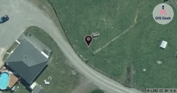
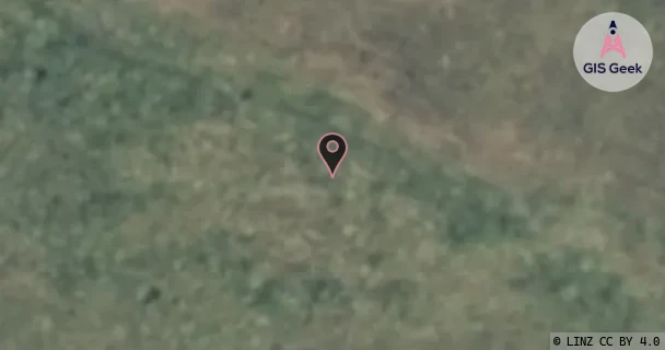
The link registered to Electra Limited is a X band link at 11.525GHz. It transmits from 69 Tararua Road Levin, and is received at Moutere Hill, a distance of 6.69km.
TX: GIS Geek | LINZ | GMaps | Street View
RX: GIS Geek | LINZ | GMaps | Street View
Login required to upload photos or suggest corrections.
Licence and Location Details
| TX: 69 Tararua Road Levin | |
|---|---|
| Antenna | ANDREW - VHLP2-11W |
| Antenna Type | PARABOLIC 10-11.7GHZ |
| Equipment | Nec - IPASOLINK VR SERIES |
| RX: Moutere Hill | |
|---|---|
| Antenna | ANDREW - VHLP2-11W |
| Antenna Type | PARABOLIC 10-11.7GHZ |
| Equipment | Nec - IPASOLINK VR SERIES |
Associated Licence
| #1: Moutere Hill | |
|---|---|
| Frequency | 10.995GHz |
| Frequency Range | 10.975GHz - 11.015GHz |
| Channel Width | 40MHz |
| Channel Code | 11G8 |
| Power dBW(eirp) | 20.1 |
| Emission | 40M0D7WWX |
| Licence Type | Fixed >=1 GHz (Bi-directional) |
| Commenced | - |
| Licence Last Updated | - |
| RSM Licence ID | 407180 |
| RSM Licence # | 404420 |
Additional Links From RX Location
| Client | TX Location | Band | Frequency | RX Location |
|---|---|---|---|---|
| Electra Limited | 16 Exeter St Levin | X | 11.285GHz | Moutere Hill |
| Electra Limited | Kawiu Road Substation Levin | K | 18.47GHz | Moutere Hill |
| Electra Limited | Moutere Hill | X | 10.755GHz | 16 Exeter St Levin |
| Electra Limited | Moutere Hill | X | 11.135GHz | Tunapo |
| Electra Limited | Moutere Hill | K | 19.48GHz | Kawiu Road Substation Levin |
| Electra Limited | Tunapo | X | 11.665GHz | Moutere Hill |
| Kiwirail | Moutere Hill | UHF | 851.25MHz | Pukerua Bay (Kiwirail) |
| Kiwirail | Moutere Hill | UHF | 853.75MHz | Ohau Signals |
| Kiwirail | Moutere Hill | X | 8.237GHz | North Range Road West |
| Kiwirail | Moutere Hill | X | 8.267GHz | Pukerua Bay (Kiwirail) |
| Kiwirail | North Range Road West | C | 7.926GHz | Moutere Hill |
| Kiwirail | Ohau Signals | UHF | 808.75MHz | Moutere Hill |
| Kiwirail | Pukerua Bay (Kiwirail) | UHF | 806.25MHz | Moutere Hill |
| Kiwirail | Pukerua Bay (Kiwirail) | C | 7.955GHz | Moutere Hill |