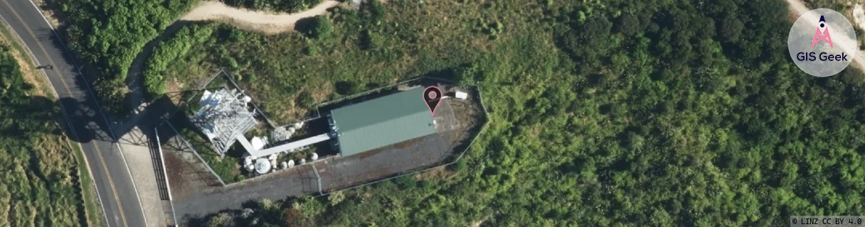
Location Overview
The Spark Kaiti Hill location is 24m high, has 6 licences associated, and is capable* of 3G UMTS, 4G LTE and 5G.
GIS Geek | LINZ | GMaps | Street View
Login required to upload photos or suggest corrections.
Closest Towers
| Provider | Location Name | Distance | Bearing |
|---|---|---|---|
| Spark | Gisborne Central | 1.6km | 329.93 |
| OneNZ | Harris Street | 845m | 8.82 |
| 2Degrees | Outer Kaiti | 1.28km | 77.24 |
| RCG | RGBTBC - Tatapouri Beach Camp | 10.46km | 70.29 |
Licence Details
Close Cell IDs Spark MMC: 530 MNC: 5
| Radio | Area | Cell | Distance from tower | Bearing from tower | Samples |
|---|---|---|---|---|---|
| UMTS | 48391 | 2917835 | 892m | 333.09 | 3 |
| UMTS | 48391 | 2917820 | 887m | 327.93 | 11 |
| UMTS | 48391 | 2917817 | 997m | 350.44 | 7 |
| UMTS | 48391 | 2917910 | 907m | 122.28 | 2 |
| UMTS | 44101 | 2917907 | 913m | 252.54 | 1 |
| UMTS | 48391 | 2917836 | 965m | 302.25 | 5 |
| UMTS | 48391 | 2917841 | 1.24km | 348.77 | 4 |
| UMTS | 48391 | 2917818 | 1.05km | 64.57 | 5 |
| UMTS | 44101 | 2917817 | 1.2km | 323.05 | 1 |
| UMTS | 48391 | 2917815 | 1.13km | 66.06 | 9 |
| UMTS | 44101 | 2917841 | 1.42km | 334.99 | 1 |
| UMTS | 44101 | 2917838 | 1.47km | 329.86 | 1 |