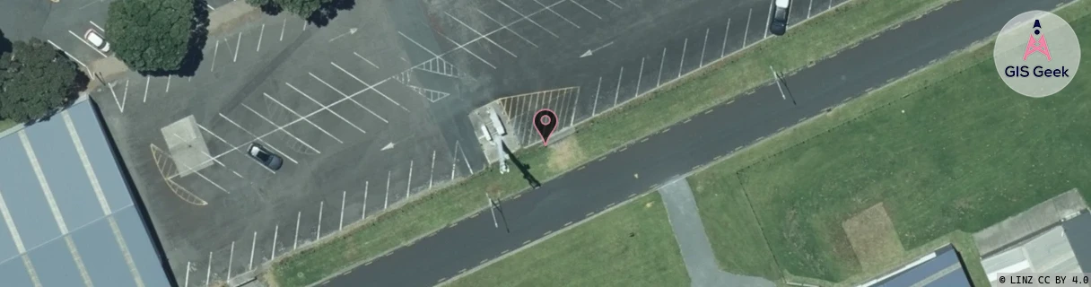
Location Overview
The Spark New Plymouth Airport location is 17m high, has 6 licences associated, and is capable* of 3G UMTS, 4G LTE and 5G.
GIS Geek | LINZ | GMaps | Street View
Login required to upload photos or suggest corrections.
Closest Towers
| Provider | Location Name | Distance | Bearing |
|---|---|---|---|
| Spark | Bell Block East | 2.98km | 207.32 |
| OneNZ | New Plymouth Airport | 0m | 0 |
| 2Degrees | S_New Plymouth Airport | 1m | 1.18 |
| RCG | RTRHUI - Huirangi | 7.67km | 131.77 |
Licence Details
Close Cell IDs Spark MMC: 530 MNC: 5
| Radio | Area | Cell | Distance from tower | Bearing from tower | Samples |
|---|---|---|---|---|---|
| LTE | 48151 | 651129 | 878m | 96.57 | 3 |
| LTE | 48151 | 76877681 | 1.55km | 159.4 | 25 |
| UMTS | 48394 | 3191379 | 1.59km | 173.01 | 5 |
| LTE | 48151 | 337777 | 1.68km | 181.38 | 1 |
| LTE | 48151 | 472179 | 1.68km | 181.38 | 1 |
| LTE | 48151 | 472195 | 1.36km | 71.8 | 1 |
| UMTS | 48394 | 3191381 | 1.36km | 71.8 | 1 |
| LTE | 48151 | 76878705 | 1.56km | 142.76 | 4 |
| UMTS | 48394 | 3191302 | 1.77km | 189.89 | 1 |
| UMTS | 48394 | 3191412 | 1.97km | 216.04 | 2 |
| LTE | 48151 | 337775 | 1.92km | 134.38 | 9 |
| LTE | 48151 | 336259 | 2.01km | 229.65 | 5 |