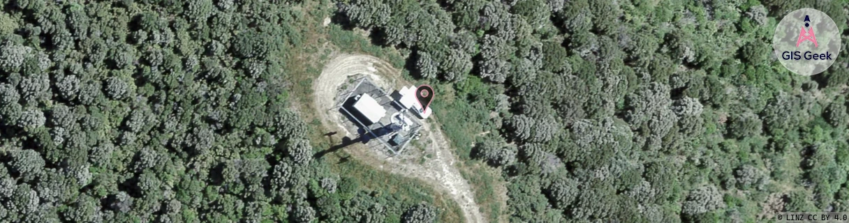
Location Overview
The 2Degrees Featherston location is 19m high, has 4 licences associated, and is capable* of 3G UMTS and 4G LTE.
Location Raw Name: (WLG-050-001-A)[FTSN]_FEATHERSTON
GIS Geek | LINZ | GMaps | Street View
Login required to upload photos or suggest corrections.
Closest Towers
| Provider | Location Name | Distance | Bearing |
|---|---|---|---|
| Spark | Featherston | 544m | 313.11 |
| OneNZ | Featherston | 63m | 166.64 |
| 2Degrees | Kaitoke | 10.79km | 299.62 |
| RCG | RWLMAY - Maymorn | 15.07km | 269.34 |
Licence Details
Close Cell IDs 2Degrees MMC: 530 MNC: 24
| Radio | Area | Cell | Distance from tower | Bearing from tower | Samples |
|---|---|---|---|---|---|
| LTE | 62213 | 1778967 | 979m | 166.69 | 44 |
| GSM | 819 | 18412 | 1.25km | 138.09 | 22 |
| LTE | 62213 | 1779068 | 1.65km | 125.62 | 73 |
| UMTS | 22213 | 26405401 | 2.31km | 122.35 | 1 |
| UMTS | 22213 | 26405398 | 2.4km | 120.74 | 1 |
| UMTS | 22213 | 26405399 | 2.62km | 268.2 | 1 |
| UMTS | 22213 | 355773 | 3km | 110.47 | 1 |
| GSM | 213 | 28093 | 3.31km | 128.53 | 5 |