Location Overview
The 2Degrees Whatawhata location is 19m high, has 5 licences associated, and is capable* of 3G UMTS and 4G LTE.
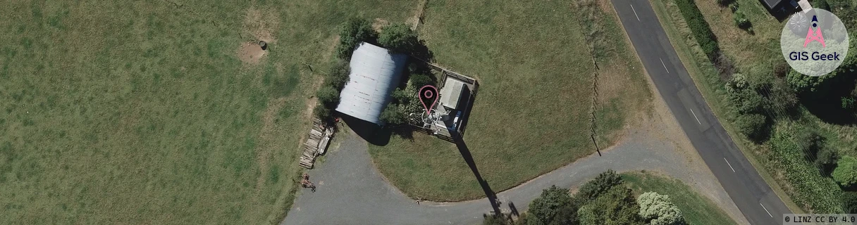
Location Raw Name: (WKT-013-008-D)[WHTA]_WHATAWHATA
GIS Geek | LINZ | GMaps | Street View
Login required to upload photos or suggest corrections.
Closest Towers
| Provider | Location Name | Distance | Bearing |
|---|---|---|---|
| Spark | Whatawhata | 951m | 233.74 |
| OneNZ | Whatawhata ONZ C1WWA | 9m | 166.06 |
| 2Degrees | Baverstock | 5.34km | 72.35 |
| RCG | RWKTPV - Temple View | 5.95km | 122.45 |
Licence Details
Close Cell IDs 2Degrees MMC: 530 MNC: 24
| Radio | Area | Cell | Distance from tower | Bearing from tower | Samples |
|---|---|---|---|---|---|
| UMTS | 22206 | 271899 | 362m | 254.05 | 9 |
| GSM | 234 | 34441 | 967m | 301.21 | 1 |
| GSM | 234 | 6283 | 1.19km | 357.7 | 2 |
| LTE | 62206 | 1756164 | 1.19km | 207.44 | 44 |
| LTE | 62206 | 1756183 | 1.32km | 211.66 | 45 |
| LTE | 62206 | 1756163 | 1.21km | 248.37 | 22 |
| UMTS | 65535 | 1758981 | 1.58km | 108.25 | 1 |
| UMTS | 22206 | 281092 | 1.67km | 239.43 | 8 |
| UMTS | 22206 | 1758981 | 1.65km | 107.33 | 1 |
| LTE | 62206 | 1758981 | 2.13km | 355.66 | 7 |