Location Overview
The 2Degrees Matangi location is 25m high, has 5 licences associated, and is capable* of 3G UMTS and 4G LTE.
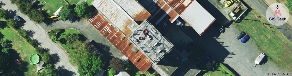
Location Raw Name: (WKT-013-014-A)[MATA]_MATANGI
GIS Geek | LINZ | GMaps | Street View
Login required to upload photos or suggest corrections.
Closest Towers
| Provider | Location Name | Distance | Bearing |
|---|---|---|---|
| Spark | Matangi | 14m | 350.32 |
| OneNZ | Matangi | 1m | 313.39 |
| 2Degrees | Tamahere | 4.35km | 230.35 |
| RCG | RWKTAW - Tauwhare | 6.49km | 74.45 |
Licence Details
Close Cell IDs 2Degrees MMC: 530 MNC: 24
| Radio | Area | Cell | Distance from tower | Bearing from tower | Samples |
|---|---|---|---|---|---|
| UMTS | 22207 | 270107 | 158m | 238.8 | 1 |
| GSM | 206 | 17663 | 620m | 78.23 | 1 |
| UMTS | 22206 | 279812 | 1.09km | 96.16 | 1 |
| UMTS | 22206 | 279813 | 1.1km | 276.52 | 1 |
| UMTS | 22206 | 269809 | 1.25km | 233.9 | 35 |
| GSM | 206 | 17661 | 1.99km | 348.15 | 2 |
| GSM | 234 | 6251 | 2.45km | 337.68 | 9 |
| UMTS | 22206 | 280112 | 2.48km | 336.25 | 5 |
| GSM | 206 | 18891 | 2.55km | 349.58 | 2 |
| UMTS | 22206 | 269807 | 2.3km | 110.06 | 4 |