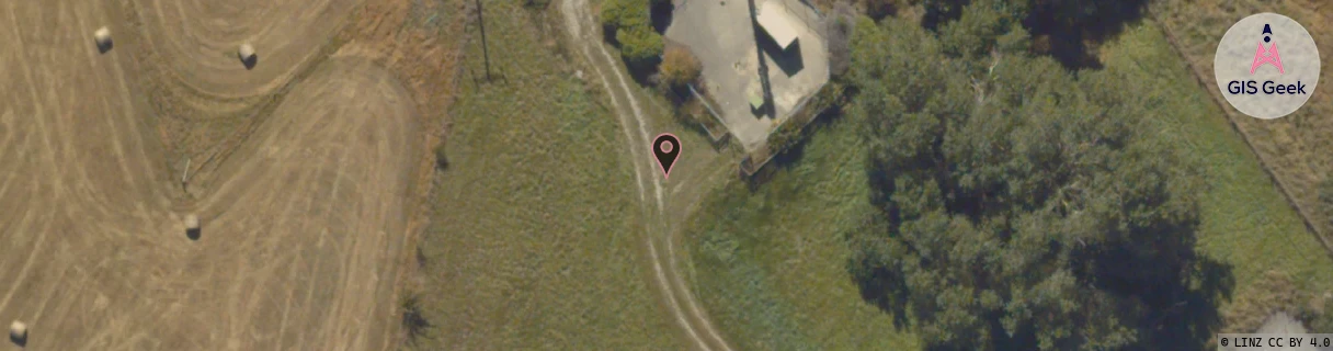
Location Overview
The 2Degrees Frankton location is 14m high, has 6 licences associated, and is capable* of 3G UMTS, 4G LTE and 5G.
Location Raw Name: (OTG-070-005-A)[FRNK]_FRANKTON
GIS Geek | LINZ | GMaps | Street View
Login required to upload photos or suggest corrections.
Closest Towers
| Provider | Location Name | Distance | Bearing |
|---|---|---|---|
| Spark | Queenstown Airport | 1.69km | 185.69 |
| OneNZ | Queenstown Airport (VF S5QTA) | 17m | 102.98 |
| 2Degrees | Remarkables Park | 1.74km | 180.53 |
| RCG | ROTWQT - West Queenstown | 22.41km | 236.58 |
Licence Details
Close Cell IDs 2Degrees MMC: 530 MNC: 24
| Radio | Area | Cell | Distance from tower | Bearing from tower | Samples |
|---|---|---|---|---|---|
| LTE | 62219 | 2802692 | 232m | 152.06 | 5 |
| UMTS | 22219 | 424023 | 249m | 126.88 | 22 |
| LTE | 62219 | 2803207 | 246m | 241.13 | 32 |
| LTE | 62219 | 2802690 | 311m | 92.29 | 9 |
| LTE | 62219 | 2802694 | 672m | 222.67 | 4 |
| UMTS | 22219 | 19758691 | 887m | 68.59 | 1 |
| UMTS | 22219 | 956581 | 1.06km | 221.63 | 1 |
| LTE | 62219 | 1717510 | 1.2km | 204.44 | 27 |
| UMTS | 22219 | 19785699 | 1.21km | 211.75 | 11 |
| UMTS | 22219 | 424164 | 1.32km | 164.44 | 13 |
| UMTS | 22219 | 817239 | 1.29km | 208.77 | 18 |
| LTE | 62219 | 1692518 | 1.7km | 192.95 | 4 |