Location Overview
The 2Degrees Harbour View location is 14m high, has 5 licences associated, and is capable* of 3G UMTS and 4G LTE.
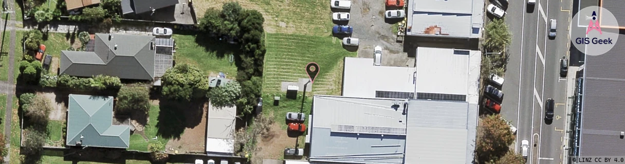
Location Raw Name: (AKL-006-036-G)[HRBV]_HARBOUR VIEW
GIS Geek | LINZ | GMaps | Street View
Login required to upload photos or suggest corrections.
Closest Towers
| Provider | Location Name | Distance | Bearing |
|---|---|---|---|
| Spark | Te Atatu North | 1.31km | 345.33 |
| OneNZ | Te Atatu Central | 795m | 178.89 |
| 2Degrees | Te Atatu North | 1.26km | 344.8 |
| RCG | RAKSMR - Summit Road | 12.71km | 266.15 |
Licence Details
Close Cell IDs 2Degrees MMC: 530 MNC: 24
| Radio | Area | Cell | Distance from tower | Bearing from tower | Samples |
|---|---|---|---|---|---|
| UMTS | 10004 | 1580548 | 460m | 348.48 | 2 |
| LTE | 61004 | 1580548 | 464m | 173.3 | 11 |
| UMTS | 10002 | 1583106 | 546m | 141.63 | 1 |
| UMTS | 10004 | 81894 | 653m | 184.78 | 8 |
| UMTS | 10004 | 81884 | 633m | 309.54 | 1 |
| UMTS | 10003 | 81884 | 760m | 4.51 | 5 |
| UMTS | 10004 | 71889 | 826m | 205.03 | 20 |
| UMTS | 10004 | 1585154 | 830m | 304.01 | 5 |
| UMTS | 10004 | 81613 | 968m | 165.55 | 20 |
| LTE | 61004 | 2988292 | 856m | 304.67 | 1 |